Community forestry (2008-2017)
Published by: Open Development Cambodia
Data Resources (8)
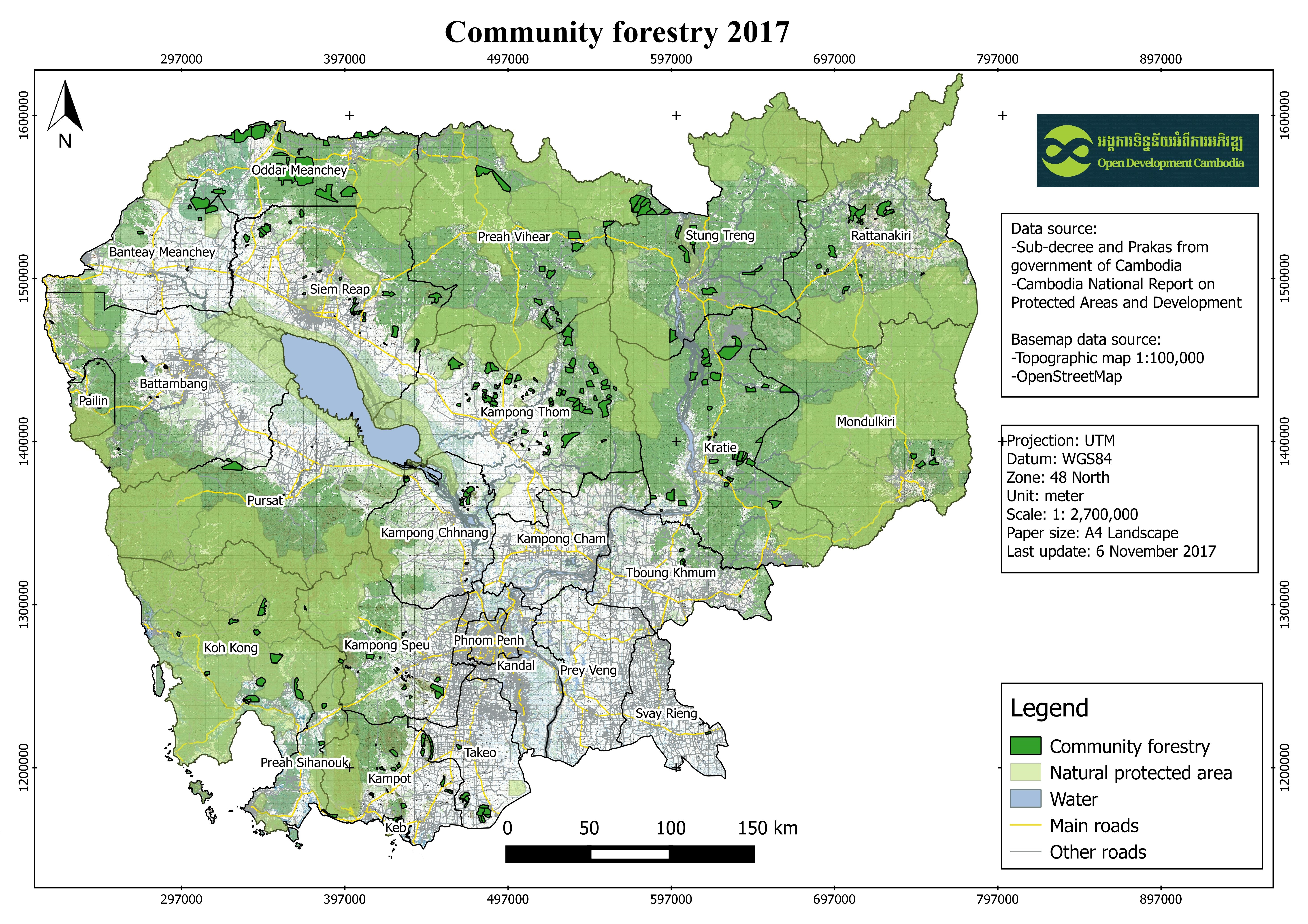
Data Resource Preview - Community forestry (2008-2017)
Additional Info
| Field | Value |
|---|---|
| Dataset topic category | Community forest |
| Language |
|
| Use limitations | By accessing this website or database, users agree to take full responsibility for reliance on any site information provided and to hold harmless and waive any and all liability against individuals or entities associated with its development, form and content for any loss, harm or damage suffered as a result of its use. |
| Dataset reference date | May 22, 2014 |
| Temporal extent's start date | November 19, 2008 |
| Temporal extent's end date | September 26, 2017 |
| GeoNames |
|
| West bounding coordinates | 102.36751670419709 |
| East bounding coordinates | 107.4184052909995 |
| South bounding coordinates | 10.489464094864589 |
| North bounding coordinates | 14.424182141173187 |
| Spatial Reference System | WGS 84 / UTM zone 48N (EPSG:32648) |
| Positional Accuracy | There are no known issues with logical accuracy. |
| Logical Consistency | There are no known issues with logical consistency. |
| Completeness | This dataset contains all of the data that is currently available to Open Development Cambodia (ODC) and is not exhaustive. While ODC takes every effort to ensure that both spatial and non-spatial data are accurate and up to date, some information of the CFs may have changed since the dataset and map were published. Moreover, additional CFs, which is not yet included here, may have been approved and established. |
| Process Step | Available data was collected from many sources by ODC’s mappers such as the Prakas from MAFF and report from Forestry Administration in hard and soft copies of pdf format. The data in pdf format was then transformed into shapefile format. When the map is not available in the sources, the data is digitized by based on the location stated in the source. The data in shapefile format was finally exported to CSV, KMZ, and GEOJSON files. |
| Lineage | The reference sources were taken from Prakas from Ministry of Agriculture Forestry and Fisheries from 2008-2014 and Community Forestry Statistic in Cambodia 2013 from Forestry Administration Department of Forest and Community Forestry. |
| Responsible party | Ministry of Agriculture Forestry and Fisheries Address : No. 200, Norodom Bvl, Phnom Penh, Cambodia Tel : 023211351 Fax : 023 217 320 Email : info@maff.gov.kh Forestry Administration Department of Forest and Community Forestry Appartment #40, Preah Norodom Blvd., Daun Penh, Phnom Penh Cambodia Email: cf.statistic@gmail.com Website: forestry.gov.kh |
| Metadata creator information | Metadata last updated on 2016-07-04. For inquiries contact: Open Development Cambodia Address: #43, St. 208, Sangkat Boeung Riang, Khan Daun Penh, Phnom Penh, Cambodia. Tel: +855 23 221 164 Email: contact@opendevcam.net Website: https://cambodia.opendevelopmentmekong.net/ |
| Attributes | name: name of community;size_ha: size of community in hectares;province: province name;district: district name;commune: commune name;type_area: type of that area;categor_en: category in English;issuedate: issue date of community ;reference: reference documents;last_update: date of update;language: language |
| License | CC-BY-SA-4.0 |
| Copyright | Yes |
| Version | 1.0 |
| Date uploaded | July 4, 2016, 3:26 AM (UTC+00:00) |
| Date modified | November 27, 2024, 7:57 AM (UTC+00:00) |