Fisheries resource management information
Flooded Forest Area
Create Map

-

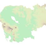
 Georelief
 -

 Hillshade
 -

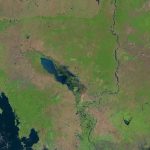
 Landsat
LEGEND
Community fisheries
Community Fisheries boundaries.
Fish Sanctuaries
Fish sanctuaries allotments.
Flooded Forest
Data represents the boundary of the flooded forest within the Tonle Sap Lake.
 Open Development Cambodia (ODC) | https://opendevelopmentcambodia.net/profiles/fisheries-conservation-areas/
Created date: 22 Dec 2025
f_ff_37
| Area name | Flooded Forest Area |
| Size in hectare | 647,406 |
| Province | Kampong Chhnang, Pursat, Battambang, Banteay Meanchey, Siem Reap, Kampong Thom |
| District | Not found |
| Commune | Not found |
| Category | Flooded Forest |
| Region | Inland fishery |
| Issue date | 29/8/2011 |
Reference documents
|
Sub-decree No.197 on boundary establishment of flooded forest site surrounding Tonle Sap lake in 6 provinces, including Kampong Chhnang province, Pursat province, Battambang province, Banteay Meanchey province, Siem Reap province and Kampong Thom Province with total land area of 647, 406
(2011-08-29)
|
The boundary of flooded forest surrounding Tonle Sap lake has been established in 6 provinces, including Kampong Chhnang province, Pursat province, Battambang province, Banteay Meanchey province, Siem Reap province and Kampong Thom Province. The total land area of this boundary is 647, 406 Hectares. Coordination is presented within the annex table. |

