ទេសភាពតំបន់ព្រៃឡង់
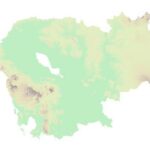
ផែនទីគោល៖ ប្រទេសកម្ពុជា (២០១៤)
ទិន្នន័យនេះបង្ហាញពីព្រំប្រទល់រដ្ឋបាលកម្រិតខេត្ត ស្រុក និងឃុំ ដែលផ្តល់ដោយ ការិយាល័យសម្របសម្រួលការងារមនុស្សធម៌ (OCHA) មករក្សាទុកក្នុងប្រព័ន្ធ Humanitarian Data Exchange (HDX)។ ទិន្នន័យនេះត្រូវបានយកពីអគ្គនាយកដ្ឋានភូមិសាស្ត្រនៃក្រសួងរៀបចំដែនដី នគរូបនីយកម្ម និងសំណង់ ក្នុងឆ្នាំ២០០៨ និងបានធ្វើបច្ចុប្បន្នភាពក្រៅផ្លូវការនៅឆ្នាំ២០១៤ដោយយោងតាម អនុក្រឹត្យស្តីពីការកែសម្រួល ឬបង្កើតខ្សែព្រំប្រទល់។ ការផ្លាស់ប្តូរចុងក្រោយគឺការបន្ថែមខេត្តត្បូងឃ្មុំ និង ស្រុក ឃុំផ្សេងៗ។
License: cc-by
សម្បទានដីសេដ្ឋកិច្ច
សំណុំទិន្នន័យនេះ មានបញ្ជីសម្បទានដីសេដ្ឋកិច្ចជាមួយនឹងកាលបរិច្ឆេទចុះកិច្ចសន្យា ពីឆ្នាំ ១៩៩៥ ដល់ ២០១៤ នៅក្នុងប្រទេសកម្ពុជា។ បញ្ជីសម្បទាននេះ ត្រូវបានធ្វើបច្ចុប្បន្នភាពនៅខែវិច្ឆិកា ឆ្នាំ២០១៧ ដោយមានបង្ហាញពីការផ្លាស់ប្តូរនូវកិច្ចសន្យាសម្បទានដីសេដ្ឋកិច្ចមួយចំនួន ជាលទ្ធផលនៃសេចក្តីណែនាំលេខ ០១ ពីឆ្នាំ ២០១២ ដូចជាការកាត់ដី និងការផ្អាកផ្តល់អាជ្ញាប័ណ្ណ។ ដោយសារកង្វះព័ត៌មានជាសាធារណៈ សំណុំទិន្នន័យនេះ មិនមានបញ្ចូលព័ត៌មានអំពីការកាត់បន្ថយរយៈពេលកិច្ចសន្យា ដែលជាលទ្ធផលនៃដំណើរការវាយតម្លៃសម្បទានដីសេដ្ឋកិច្ច ដែលបានធ្វើឡើងនៅឆ្នាំ២០១៥ឡើយ។ ទិន្នន័យនេះនឹងធ្វើបច្ចុប្បន្នភាពតាមរយៈ ការប្រមូលចេញពីប្រភពផ្សេងៗដូចជា រដ្ឋាភិបាល អង្គការមិនមែនរដ្ឋាភិបាល ស្ថាប័នស្រាវជ្រាវ គេហទំព័រក្រុមហ៊ុន និងរបាយការណ៍សារព័ត៌មានផ្សេងៗ។ ទិន្នន័យភូមិសាស្រ្តនេះ ត្រូវបានកំណត់យកតាមប្រព័ន្ធគោល WGS 84, Zone 48N។
License: cc-by
ដកហូត
សម្បទានដីសេដ្ឋកិច្ចនេះ ត្រូវបានលុបចោលដោយមាន ឬគ្មានការកាត់បន្ថយទំហំដីពីមុន។កាត់បន្ថយបន្ទាប់ពីដកហូត
ទំហំដីសម្បទាន ត្រូវបានកាត់បន្ថយ បន្ទាប់ពីមានការដកហូតអាជ្ញាប័ណ្ណពីមុន។ ឯកសារស្តីពីការកាត់បន្ថយផ្ទៃដីចេញពីសម្បទានដីសេដ្ឋកិច្ចដែលមានជាសាធារណៈ ពំុមានភ្ជាប់ផែនទីមកជាមួយឡើយ។ ដូច្នេះអូឌីស៊ី មិនអាចបង្ហាញផ្ទៃដីដែលត្រូវបានកាត់ចេញនៅលើផែនទី។ សម្បទានដីសេដ្ឋកិច្ចនៅលើផែនទីអន្តរកម្ម បង្ហាញនូវទំហំផ្ទៃដីដើម។
កាត់បន្ថយ
ទំហំដីសម្បទាននេះ ត្រូវបានកាត់បន្ថយ ហើយពុំមានការដកហូតអាជ្ញាប័ណ្ណពីមុនមកទេ។ ឯកសារស្តីពីការកាត់បន្ថយផ្ទៃដីចេញពីសម្បទានដីសេដ្ឋកិច្ចដែលមានជាសាធារណៈ ពុំមានភ្ជាប់ផែនទីមកជាមួយឡើយ។ ដូច្នេះអូឌីស៊ី មិនអាចបង្ហាញផ្ទៃដីដែលត្រូវបានកាត់ចេញនៅលើផែនទី។ សម្បទានដីសេដ្ឋកិច្ចនៅលើផែនទីអន្តរកម្ម បង្ហាញនូវទំហំផ្ទៃដីដើម។គ្មានភស្តុតាងនៃការផ្លាស់ប្តូរ
អូឌីស៊ីពុំទាន់មានព័ត៌មានអំពីការប្រែប្រួលពាក់ព័ន្ធនឹងសម្បទានដីសេដ្ឋកិច្ចនេះទេ ចាប់តាំងពីរាជរដ្ឋាភិបាលបានផ្តល់អាជ្ញាប័ណ្ណជាលើកដំបូង។គម្របព្រៃឈើឆ្នាំ២០១៤
សំណុំទិន្នន័យនេះ បង្ហាញអំពីគម្របព្រៃឈើនៅកម្ពុជា ឆ្នាំ២០១៤។ ទិន្នន័យភូមិសាស្រ្តនេះ ត្រូវបានកំណត់យកតាមប្រព័ន្ធគោល WGS 84, Zone 48N។ ទិន្នន័យ ត្រូវបានដកស្រង់ជាទម្រង់រ៉ាស្ទើ ពីគេហទំព័ររបស់ទីភ្នាក់ងារស្រាវជ្រាវភូគព្ភសាស្ត្ររបស់សហរដ្ឋអាមេរិក (USGS) និងផលិតសារជាថ្មី ដើម្បីបង្ហាញគម្របព្រៃឈើ ដោយអង្គការទិន្នន័យអំពីការអភិវឌ្ឍ។
សហគមន៍ព្រៃឈើ (២០០៨-២០១៧)
សំណុំទិន្នន័យនេះ ពណ៌នាព័ត៌មានពីសហគមន៍ព្រៃឈើនៅប្រទេសកម្ពុជា ចាប់ពីឆ្នាំ២០០៨ ដល់ឆ្នាំ២០១៧។ សហគមន៍ព្រៃឈើសរុបចំនួន ៣៣៩ ត្រូវបានកត់ត្រាទុក។ ទិន្នន័យនេះ ត្រូវបានប្រមូលយកមកពីប្រភពផ្សេងៗគ្នា ដូចជាប្រកាស និងរបាយការណ៍នានារបស់ក្រសួងកសិកម្ម រុក្ខាប្រមាញ់ និងនេសាទ និងរដ្ឋបាលព្រៃឈើជាទម្រង់ pdf ។ ទិន្នន័យភូមិសាស្ត្រ ត្រូវបានកំណត់យកតាមប្រព័ន្ធគោល WGS 84, Zone 48N។
License: CC-BY-SA-4.0
តំបន់ការពារធម្មជាតិនៅប្រទេសកម្ពុជា (១៩៩៣-២០២៣)
បណ្តុំទិន្នន័យនេះ ប្រមូលផ្តុំទិន្នន័យអំពីតំបន់ការពារនៅក្នុងប្រទេសកម្ពុជា ចំនួន ៨ ប្រភេទ (តំបន់ឧទ្យានជាតិ តំបន់ដែនជម្រកសត្វព្រៃ តំបន់ការពារទេសភាព តំបន់ប្រើប្រាស់ច្រើនយ៉ាង តំបន់បេតិកភ័ណ្ឌធម្មជាតិ តំបន់រ៉ាមសារ តំបន់ស្នូលនៃឋបនីយជីវមណ្ឌលនិងតំបន់ឧទ្យានជាតិសមុទ្រ) ជាមួយនឹងកាលបរិច្ឆេទ នៃការបង្កើត ចាប់ពីឆ្នាំ១៩៩៣ ដល់ ឆ្នាំ២០២៣។ ទិន្នន័យនេះ ត្រូវបានប្រមូលមកពីទីភ្នាក់ងាររដ្ឋាភិបាល និងអង្គការមិនមែនរដ្ឋាភិបាល ជាទម្រង់ pdf and shapefile ។ ទិន្នន័យភូមិសាស្ត្រ ត្រូវបានកំណត់យកតាមប្រព័ន្ធគោល WGS 84, Zone 48N។
License: cc-by
Prey Lang in focus
 |  |  | ||
| What is Prey Lang? | Prey Lang protection | Prey Lang’s biodiversity database | Multimedia of species and habitat | E-library |


