Mining concessions
- 12 September 2017
- Mining
Create Map

-

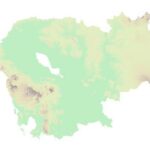
 Georelief
 -

 Hillshade
 -

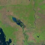
 Landsat
Map Layers
LEGEND
All mining concessions
This dataset contains data for mining concessions in Cambodia’s from 1995 to 2014. The data was collected from many sources by ODC’s mappers such as government, news, company profiles, reports and NGO agency in both pdf and shapefile format. Geographic data is encoded in the WGS 84, Zone 48 North coordinate reference system.
Government Data Complete
Information Obtained From Official Government Sources, With Official Legal Documentation, In The Four Identification Fields: A. Company Name; B. Location; C. GPS Coordinates And/Or Analog Map; And D. Purpose (Crop, Ore, Etc.)
Government Data Partial
Information Obtained From Official Government Sources, With Legal Documentation, But Missing One Or More Of The Following Identification Fields: A. Company Name; B. Location; C. GPS Coordinates And/Or Analog Map; And D. Purpose (Crop, Ore, Etc.)
Secondary Sources
Information obtained from the concessionaire (company/entity) or from government source(s) without legal documentation.
Other Data
Information Obtained From Any Other Source In Public Domain (Including Documentation From Photographs, Etc.)
 Open Development Cambodia (ODC) | https://opendevelopmentcambodia.net/profiles/mining-concessions/
Created date: 24 Dec 2025
| License | Angkor Resources Corp. |
| Province | Oddar Meanchey |
| District | Not found |
| Commune | Not found |
| Size in hectare | 10,029 |
| Area name | Andong Bor |
| Contract date | 8/8/2022 |
| Mineral commodity | Copper, Gold |
| Investor nationality | Not found |
| Registered address | Not found |
| Director name | Not found |
| Director nationality | Not found |
| Mining registration | Not found |
| Company website | Not found |
| Issurance ministry | MME |
| Contract duration | 3 |
| Implement status | The Ministry of Mines and Energy (MME) has granted Angkor a 3-year exploration license |
| EIA date | Not found |
| EIA status | Not found |
| Data classification |
Secondary source data Information obtained from the concessionaire (company/entity) or from government source(s) without legal documentation. |
Reference documents
|
Webpage capture on Andong Bor exploration license
|
The article discusses the Andong Bor exploration license in northwest Cambodia. It covers an area of 100.29 km2 and is focused on exploring for copper and gold. The license has been granted to Angkor for a 3-year period, with the possibility of renewal for two additional terms. The project includes three prospects: Thmei North, Thmei South, and Minesite. Thmei North has shown high anomalous values for Cu-Au-Mo, while Minesite is prospective for lode-style gold. Various exploration activities have been conducted, including surveys, mapping, sampling, and drilling. |

