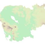
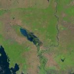
ផែនទីជីជាតិដី (២០០៣)
ផែនទីជីជាតិដី (២០០៣)
សំណុំទិន្នន័យនេះ ផ្តល់ព័ត៌មានអំពីកម្រិតជីជាតិដី នៃតំបន់ផ្សេងៗនៅកម្ពុជា។ ទិន្នន័យភូមិសាស្រ្តនេះ ត្រូវបានកំណត់យកតាមប្រព័ន្ធគោល WGS 84។ អង្គការទិន្នន័យអំពីការអភិវឌ្ឍ ទទួលបានទិន្នន័យទម្រង់ជាវ៉ិចទ័រ ពីក្រុមការងារអាត់ត្លាស របស់អង្គការសង្គ្រោះសត្វព្រៃកម្ពុជា។
License: CC-BY-4.0


