ការពង្រឹងសហគមន៍នេសាទក្នុងខេត្តកំពត និងកែបតាមរយៈការធ្វើផែនទីឌីជីថល
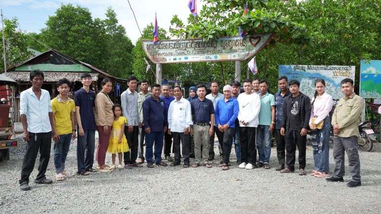
នៅថ្ងៃទី១ និងទី២ ខែកញ្ញា ឆ្នាំ២០២៥ អង្គការទិន្នន័យអំពីការអភិវឌ្ឍ (អូឌីស៊ី) បានរៀបចំវគ្គបណ្តុះបណ្តាលរយៈពេលពីរថ្ងៃនៅសហគមន៍នេសាទត្រពាំងសង្កែ ក្នុងខេត្តកំពត។ វគ្គបណ្តុះបណ្តាលនេះផ្តោតលើការធ្វើផែនទីឌីជីថលដោយសហគមន៍ និងមានការចូលរួមពីសមាជិកចំនួន ១៩ នាក់មកពីសហគមន៍នេសាទ (CFis) ក្នុងខេត្តកំពត និងខេត្តកែប។
វគ្គបណ្តុះបណ្តាលនេះគឺជាផ្នែកមួយនៃគម្រោងពង្រឹងសកម្មភាពសង្គមស៊ីវិលដើម្បីអភិបាលកិច្ចសេដ្ឋកិច្ច (SCAEG) ដែលទទួលការគាំទ្រពីសហភាពអឺរ៉ុប។ គោលបំណងនៃវគ្គបណ្តុះបណ្តាលនេះគឺដើម្បីជួយសហគមន៍មូលដ្ឋានឈ្វេងយល់ និងប្រើប្រាស់ផែនទីឌីជីថល និងឧបករណ៍ផលិតផែនទី ដើម្បីគ្រប់គ្រងធនធានធម្មជាតិ ការពារបរិស្ថាន និងគាំទ្រការងារប្រចាំថ្ងៃរបស់ពួកគេ។
ផែនទីគឺជាឧបករណ៍ដ៏សំខាន់សម្រាប់ការយល់ដឹង និងការការពារដី ទឹក និងធនធានធម្មជាតិ។ សម្រាប់សហគមន៍នេសាទ ផែនទីអាចជួយពួកគេ៖
- បង្ហាញព្រំដែននៃតំបន់នេសាទរបស់ពួកគេ
- កំណត់ធនធានធម្មជាតិសំខាន់ៗ (ដូចជាព្រៃកោងកាង ឬជម្រកត្រី)
- កត់ត្រាបញ្ហា ឬការគំរាមកំហែង (ដូចជាការនេសាទខុសច្បាប់ ឬការបំពុល)
- ផែនការសម្រាប់ការអភិរក្ស និងអភិវឌ្ឍន៍សហគមន៍
ទោះជាយ៉ាងណាក៏ដោយ សមាជិកសហគមន៍ជាច្រើនមិនមានលទ្ធភាពប្រើប្រាស់ឧបករណ៍ឌីជីថល ឬទទួលការបណ្តុះបណ្តាលដើម្បីប្រើប្រាស់ផែនទីទេ។ វគ្គបណ្តុះបណ្តាលនេះមានគោលបំណងកាត់បន្ថយគម្លាតនោះ ដោយណែនាំអ្នកចូលរួមឱ្យស្គាល់ជំនាញជាមូលដ្ឋាននៃផែនទីឌីជីថល។
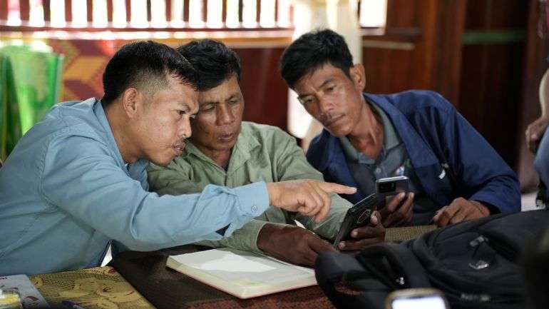
ទោះបីជាអ្នកចូលរួមភាគច្រើនមានបទពិសោធន៍តិចតួចជាមួយស្មាតហ្វូន ឬឧបករណ៍ឌីជីថលក៏ដោយ ពួកគេមានទឹកចិត្តចង់រៀនសូត្រ។ ក្រុមការងារអូឌីស៊ី បានធ្វើឱ្យការបណ្តុះបណ្តាលមានភាពសកម្ម មានការអនុវត្ត និងងាយស្រួលធ្វើតាម។ ក្នុងវគ្គបណ្តុះបណ្តាលនេះ សិក្ខាកាមបានសិក្សាអំពី៖
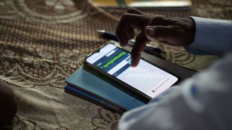
- តើផែនទីជាអ្វី និងវិធីអានផែនទី
- តើទិន្នន័យផែនទីប្រភេទណាខ្លះដែលមាននៅលើគេហទំព័ររបស់អូឌីស៊ី
- របៀបស្វែងរក និងទាញយកផែនទីឥតគិតថ្លៃ
- របៀបប្រើ Avenza Maps ដែលជាកម្មវិធីទូរស័ព្ទឥតគិតថ្លៃដែលដំណើរការដោយគ្មានអ៊ីនធឺណិត
កម្មវិធីនេះមានភាពងាយស្រួលក្នុងការប្រើប្រាស់ និងដំណើរការបានយ៉ាងល្អនៅលើទូរសព្ទដៃ ទោះបីជាមិនមានការតភ្ជាប់អ៊ីនធឺណិតក៏ដោយ។ វាមានប្រយោជន៍ជាពិសេសសម្រាប់សហគមន៍នៅតំបន់ដាច់ស្រយាល។ ដំបូង អ្នកចូលរួមមួយចំនួនមានអារម្មណ៍ថាមិនប្រាកដក្នុងការប្រើប្រាស់ឧបករណ៍ឌីជីថល។ មិនមែនគ្រប់គ្នាសុទ្ធតែធ្លាប់មានបទពិសោធន៍ជាមួយស្មាតហ្វូន ឬកម្មវិធីផែនទីនោះទេ។ ទោះជាយ៉ាងណាក៏ដោយ តាមរយៈការណែនាំ និងការអនុវត្តជាជំហានៗ ពួកគេកាន់តែមានទំនុកចិត្ត។
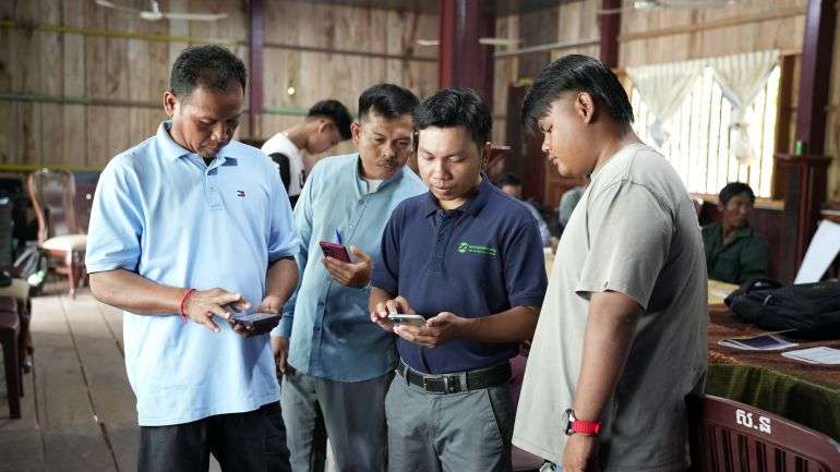
ដើម្បីវាស់ស្ទង់វឌ្ឍនភាពរបស់អ្នកចូលរួម អូឌីស៊ីបានធ្វើការធ្វើតេស្តមុន និងក្រោយការបណ្តុះបណ្តាល។ លទ្ធផលបានបង្ហាញថាអ្នកចូលរួមភាគច្រើនបានរៀនច្រើនក្នុងអំឡុងពេលពីរថ្ងៃ។ ឥឡូវនេះពួកគេអាចកំណត់អត្តសញ្ញាណឧបករណ៍គូសផែនទីសំខាន់ៗ និងប្រើប្រាស់ផែនទី Avenza ដើម្បីប្រមូលទិន្នន័យលំហនៅក្នុងសហគមន៍របស់ពួកគេផ្ទាល់។
វគ្គបណ្តុះបណ្តាលនៅសហគមន៍នេសាទត្រពាំងសង្កែនេះគឺជាផ្នែកមួយនៃកិច្ចខិតខំប្រឹងប្រែងរបស់អូឌីស៊ី ដើម្បីនាំយកឧបករណ៍ឌីជីថល និងចំណេះដឹងដល់សហគមន៍មូលដ្ឋាន។ តាមរយៈការគាំទ្រដល់អ្នកដឹកនាំសហគមន៍ និងសមាជិកដែលមានជំនាញថ្មីៗ អូឌីស៊ីសង្ឃឹមថានឹងពង្រឹងការគ្រប់គ្រងធនធានតាមសហគមន៍ និងលើកកម្ពស់ការធ្វើសេចក្តីសម្រេចប្រកបដោយបរិយាបន្នបន្ថែមទៀត។