Mining concessions
- 12 September 2017
- Mining
Create Map

-

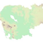
 Georelief
 -

 Hillshade
 -

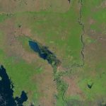
 Landsat
Map Layers
LEGEND
All mining concessions
This dataset contains data for mining concessions in Cambodia’s from 1995 to 2014. The data was collected from many sources by ODC’s mappers such as government, news, company profiles, reports and NGO agency in both pdf and shapefile format. Geographic data is encoded in the WGS 84, Zone 48 North coordinate reference system.
Government Data Complete
Information Obtained From Official Government Sources, With Official Legal Documentation, In The Four Identification Fields: A. Company Name; B. Location; C. GPS Coordinates And/Or Analog Map; And D. Purpose (Crop, Ore, Etc.)
Government Data Partial
Information Obtained From Official Government Sources, With Legal Documentation, But Missing One Or More Of The Following Identification Fields: A. Company Name; B. Location; C. GPS Coordinates And/Or Analog Map; And D. Purpose (Crop, Ore, Etc.)
Secondary Sources
Information obtained from the concessionaire (company/entity) or from government source(s) without legal documentation.
Other Data
Information Obtained From Any Other Source In Public Domain (Including Documentation From Photographs, Etc.)
 Open Development Cambodia (ODC) | https://opendevelopmentcambodia.net/profiles/mining-concessions/
Created date: 24 Dec 2025
| License | Jogmec |
| Province | Pursat |
| District | Not found |
| Commune | Not found |
| Size in hectare | Not found |
| Area name | Not found |
| Contract date | Not found |
| Mineral commodity | Not found |
| Investor nationality | Japan |
| Registered address | Not found |
| Director name | Not found |
| Director nationality | Not found |
| Mining registration | Not found |
| Company website | https://www.jogmec.go.jp/english/ |
| Issurance ministry | Not found |
| Contract duration | Not found |
| Implement status | Not found |
| EIA date | Unknown |
| EIA status | Not found |
| Data classification |
Government data partial Information obtained from official Government sources, with legal documentation, but missing one or more of the following identification fields: |
Reference documents
|
Report: 2011 results & 2012 work plan - general department of mine resources
|
This content had detailed information of 2011 work achievement of Department of Mine Resource, Ministry of Industry, Mine and Energy; and of 2012 work plan. In 2011, the officers from the ministry and JICA expert team worked together to conduct a geographical research – field works conducted in Kratie, Steung Treng, and Ratanakiri for five day; and geographical survey with other companies exploring mine coal in Steung Treng; Kampong Thom; Mondulkiri; Odor Mean Chey; Banteay Mean Chey; Pursat; Preah Vihear; Takeo; and Kampot. Mine resource research – in 2011, the ministry granted business license to 24 companies to explore and doing research on mine potentiality prior to their operation. Thus the ministry sent the officers to study with companies on gold, ore mine, coal and metal mines; and did a summary of 2010 achievement and 2011 work plan. Mine for construction sector – granted 47 new licenses to operate stone quarry, extended 147 licenses, and terminate 50 licenses. Documentation and business registration work – update 48 companies address; revised fee charge to 5 companies; rewarded 24 new licenses; and 29 licenses to do metal mine; registered new 28 mining businesses; and terminated 11 exploring licenses. Database management – data on coal mining, stone quarry, and mine exploring study had been kept via GIS in a database. Cooperation and training – cooperation with KORES on Air Borne Survey in Steung Treng was for two weeks. The ministry signed MOU with UNDP on improving mine resource sector supported preparing national policy and law on mine for sustainability. Producing two years’ work plan 2011-2012 enabled supporting department of mine resource on national policy on mine. In regard to training, the ministry worked with AOTS, JICA, UNDP to provide training and learning opportunity inside and abroad. Tax collection on mine had been collected and monitored. And gender issues at workplace had been promoted via recruitment more female resource. |

