Success story from fundamentals of QGIS trainings with Royal University of Agriculture
A training program on fundamentals of QGIS was organized at geographic information system (GIS) lab of Faculty of Land Management and Land Administration, at Royal University of Agriculture. In the program, land management and environment were considered as the main theme. The participants were trained on the principle of GIS and its application with QGIS for map visualization, management of spatial data, open source database, methods of spatial data collection through georeferencing and digitization and spatial analysis with geoprocessing toolbox accordingly. The training was organized by Map and Data Team of Open Development Cambodia under the cooperation with Faculty of Land Management and Land Administration, Royal University of Agriculture.
The program was organized for two times from 13th to 17th and 27th to 31st of August, 2018 respectively due to the number of registration and limited seat in the lab. 48 participants including 16 females were students of the faculty. Six students from the first training were keen to assist in the second training as the co-facilitators.
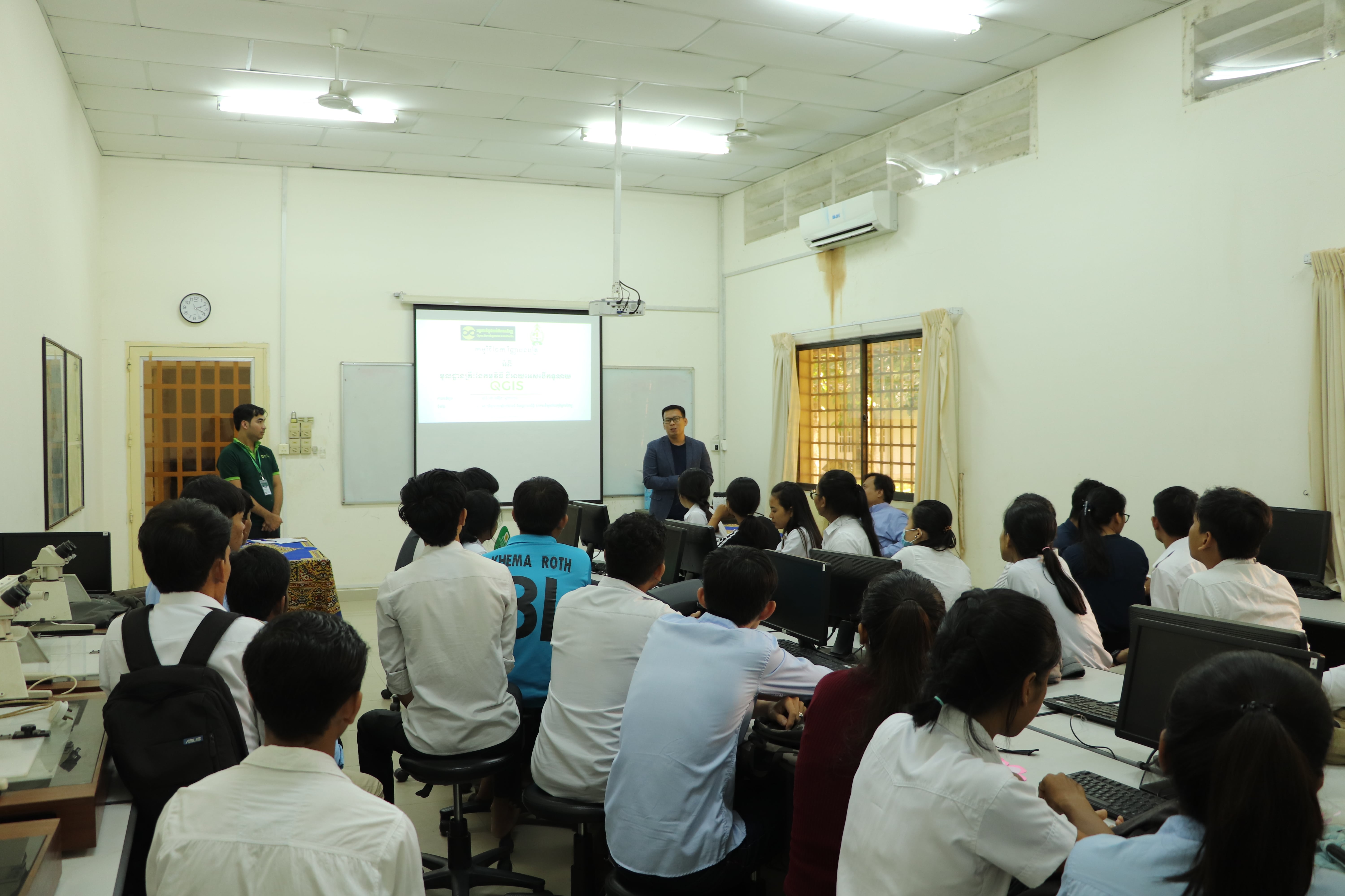
Mr. Thy Try, Executive Director of Open Development Cambodia, gave a speech to the students.
The interactive classroom management was used in this training through lecture, hands-on skills by working individually and in a group in a computer-based practice mini project, and group presentation. During the last 3 days of each training, the students were given exam in a group of 5 under the topic of “mapping land use of university”. They used rigorous knowledge acquired from the first day to complete this task successfully such as georeferencing imagery, spatial data management, visualization and map design. Then the representative of each group delivered a presentation about their results.
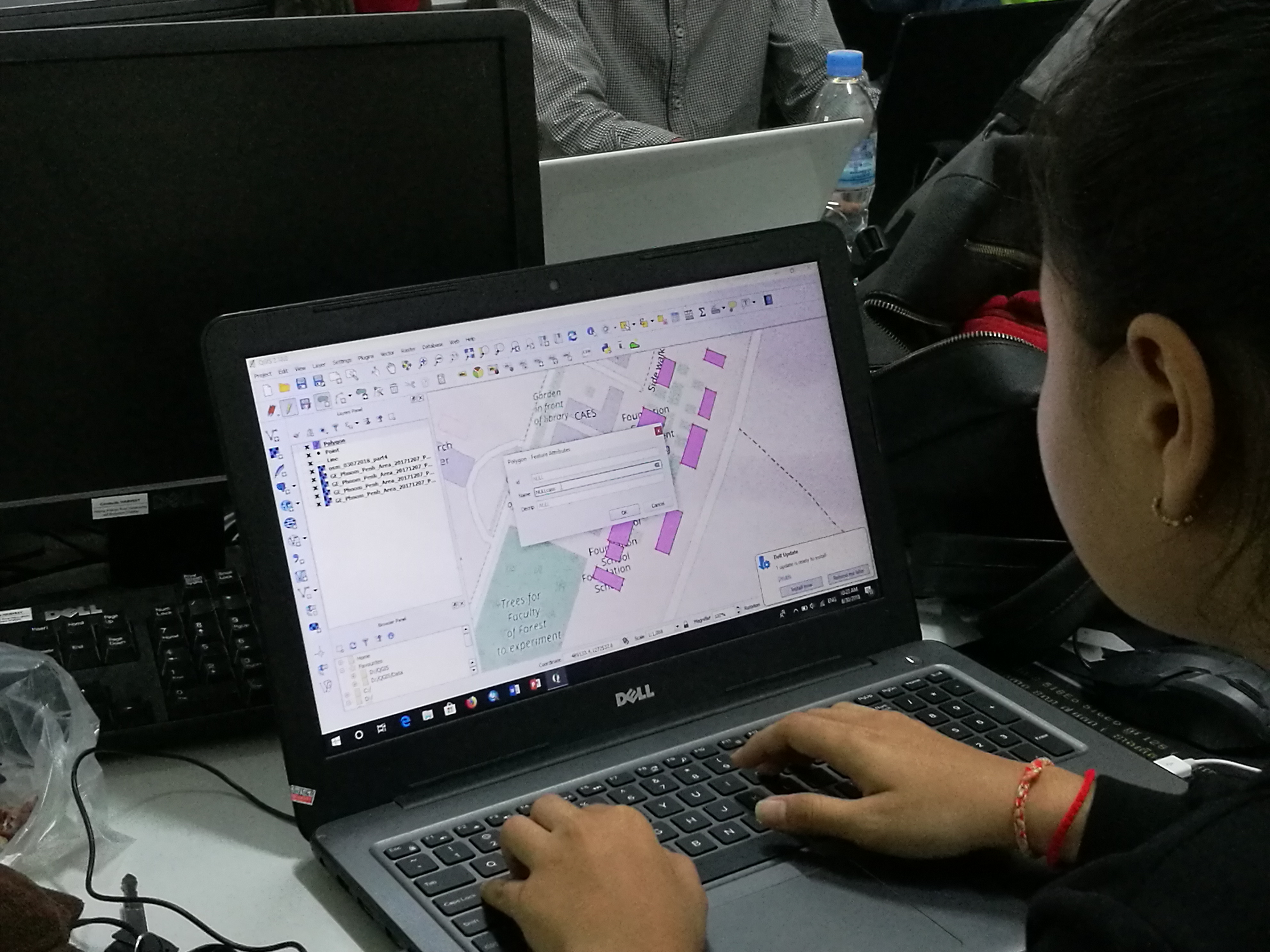
Student was paying attention to the practical exercise.
The participants completed comprehensive evaluation form of the training program in order to analyze the performance and issues of the training in order to improve the quality of future program and deliver training that meets higher quality standards.
Overall, the training has completed successfully with high satisfaction according to the evaluation form from 35 participants. All students expressed that their expectations had been fulfilled. They were very satisfied to both the training content and trainer and would like to recommend this course to their friends, juniors and other students.
On 12 November, ODC team in collaboration with the Faculty of Land Management and Land Administration (FLMLA), celebrated a certificate award ceremony for the successful students. At the ceremony, a number of maps produced by the students were selected and showed off. The outstanding maps were printed and hanged at the faculty gallery. Dr. Hor Sanara, Dean of FLMLA is very appreciated with the effort that ODC had provided to the university, and he also requested ODC team to have another GIS training for next generation.
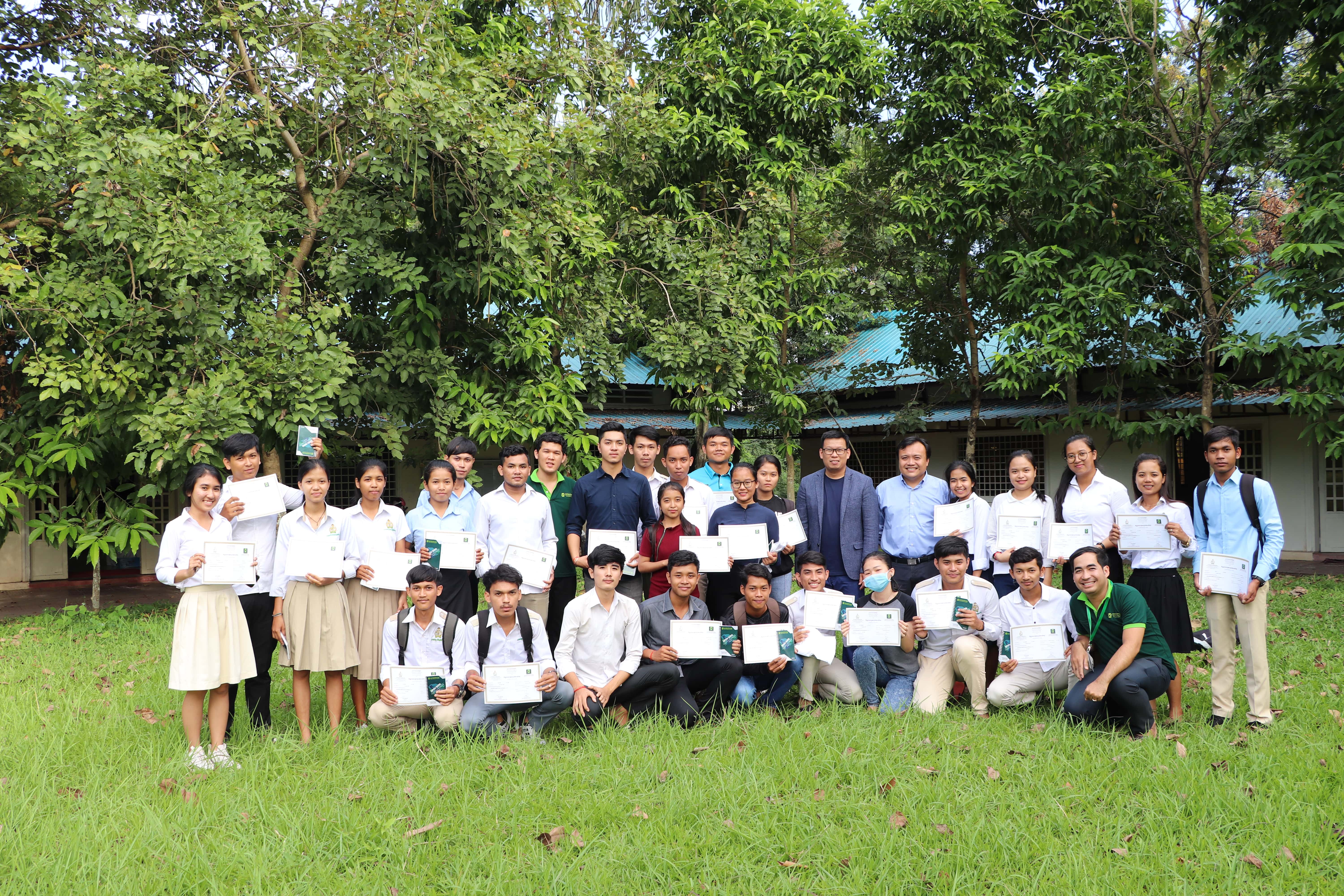
Group photo at the end of the certificate award ceremony.

